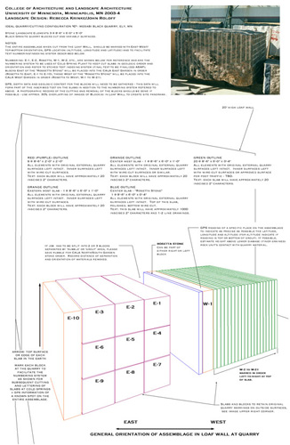
Far Left: Quarry/Cuting
Configuration "C" -
Duluth Complex Gabbro, Mesabi Black quarry, Lake Ct., MN
Stone Landscape Elements 2 @ 8'-6" x 6'-0" x
7'-6" anorthositic gabbro (Duluth Complex) quarry blocks cut and
variably surfaced.
NOTES:
The entire assemblage when cut from the Loaf Wall, should be marked
with East-West/top-bottom orientation, GPS location (altitude, longitude and latitude)
and to facilitate text numbering/indexing system described below.
Numbering: E-1, E-2, Rosetta, W-1, W-2, etc., are shown below for reference
and are the numbering system to be used at Cold Spring Plant to keep cut slabs
in geologic order and orientation and refer to etched text indexing system (final text to
be finalized ASAP); blocks East of the "Rossetta Stone" will be placed into the
CALA East Garden in order (Rosetta to East, E-1 to E-10), those West of the "Rossetta Stone" will
be placed into the CALA West Garden in order (Rosetta to West, W-1 to W-21).
GPS, depth data and geologic context for the blocks will need to be
gathered - this data will form part of the inscribed text on the slabs in addition to the numbering
system refered to above. A photographic record of the cutting and removal of the blocks
should be done if possible - use approx. 30% overlapping of images of Block(s) in Loaf
Wall to create site panorama .
|
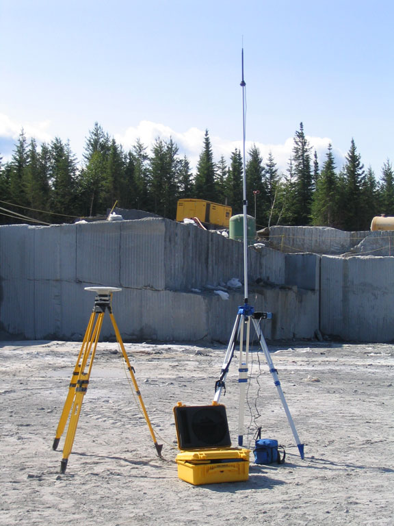
Center left: GPS Insturments
Instruments
used for
6-Satellite GPS survey by Bear Island Surveying, Ely, MN for Latitude,
Longitude and Altitude of each slab or block to be installed as part
of Site Index, in the East and West CALA Gardens. Mesabi Black Quarry,
Lake County, MN, May, 2004. Measurements were used to construct the Quarry Block Diagram (far right image) and determine an accurate quarry site position to be etched into each block for SITE INDEX.
Image courtesy of Bear Island Surveying.
|
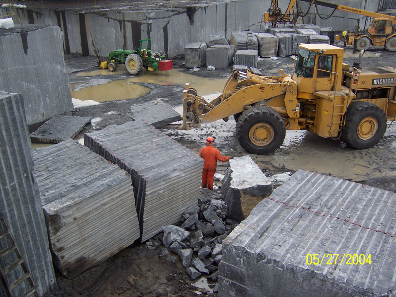
Center right: Quarry Excavation of SITE INDEX blocks.
Excavating of Anorthositic
Gabbro Blocks from loaf wall for East and West CALA Gardens Mesabi Black quarry, Lake County, MN, May, 2004.
Image courtesy of Cold Spring Granite. |
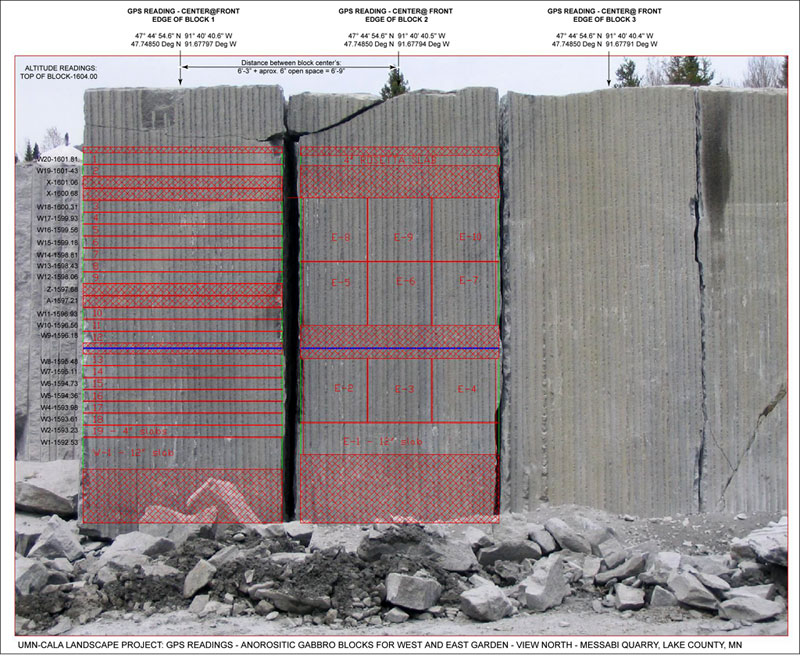
Far right: Quarry Block Diagram
and Geographic Measurements used for SITE INDEX Indexing of East and West Rapson Hall
Gardens
Slabs
and Blocks, Mesabi Black Quarry, Lake County, MN.
Latitude, Longitude
and Altitude marked on diagram for each slab or block based upon 6-Satellite GPS survey
by Bear Island Surveying, Ely, MN - see center left image and description, this page.
Block No. 1 - used for West Garden (W-1 to W-20)
Block No. 2 - used for Rosetta
Stone and East Garden (E-1 to E-10)
Block No. 3 - held in reserve. Broken
material from blocks and excavation rubble planned for use in North and South
Gardens.
Image courtesy of Cold Spring Granite.
|