San Francisco Wharf Complex - Geologic Analog/Research - Phase II of IV
Phase II Study: Stratigraphic Visualization/Analysis of selected pier as representative of SFW (Anthropocene to Mid-Tertiary) Complex
Bernard Osher Fellowship - Exploratorium, San Francisco, CA 2008-09
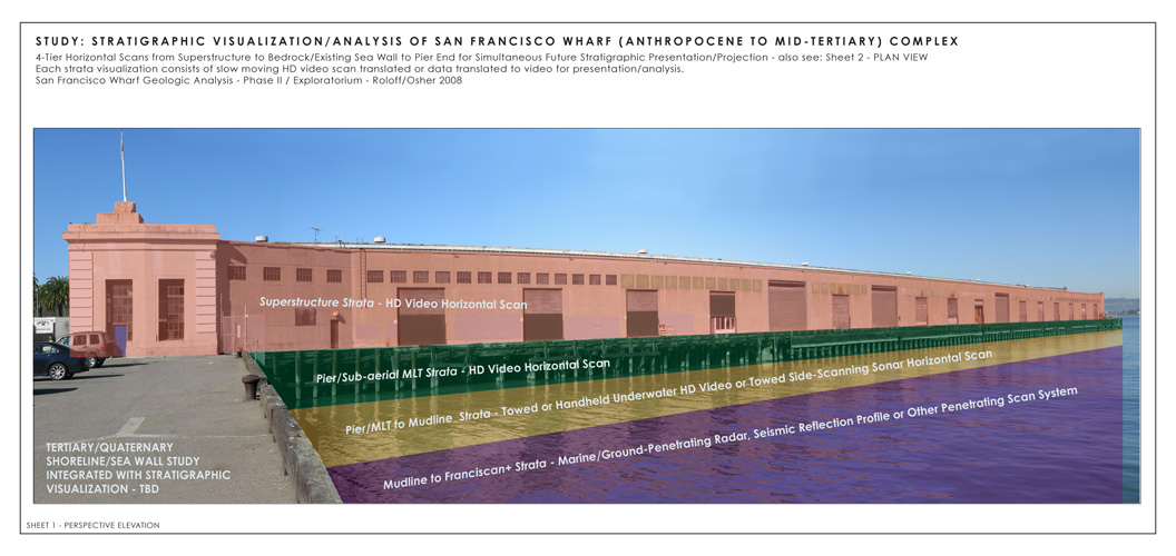
Left: view of the length of mid-wharf pier complex from the southwest, San Francisco Bay, CA, showing proposed visualization strata and relationship to other studies
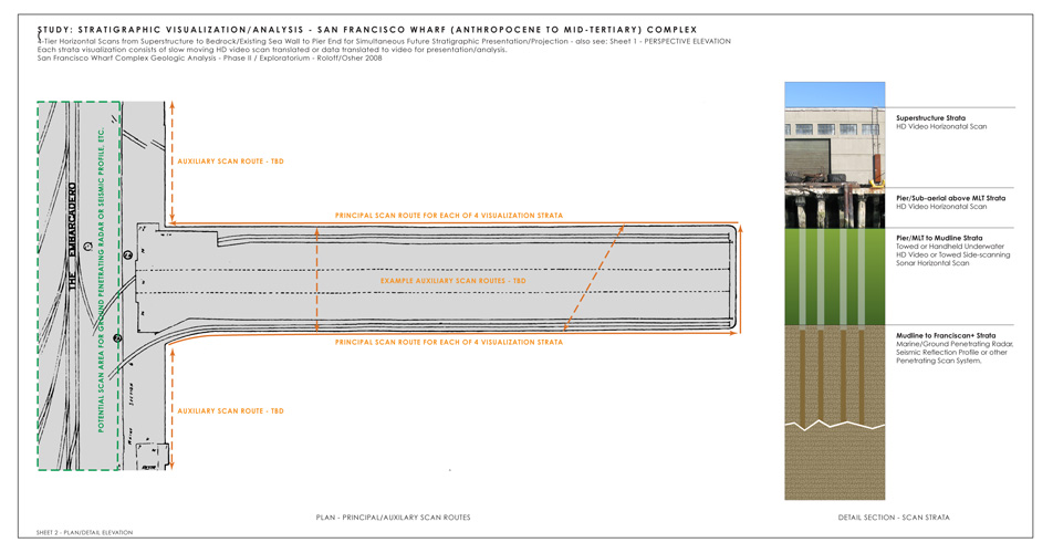
Right: plan view and detail section views of selected mid-wharf complex visualization routes and sectional designations.
San Francisco Wharf Complex Geologic Analog/Research - Phase II
4-Tier Horizontal Scans from Superstructure to Bedrock/Existing Sea Wall to Pier End for Simultaneous Future Stratigraphic Presentation/Projection
Phase II of San Francisco Wharf Complex Geologic Analog/Research is a formal visualization of the piers using HD video scan translated or other scanning technology translated to video to visualize the piers as a stratigraphic complex and its relationship to the site/regional geology. Each strata visualization consists of slow moving scans for presentation/analysis.
The underwater video may be done with a towed camera/lighting system following the same path as other above water scans of the pier. Side-scanning sonar is also an option for the water-exposed pier structure.
Ground penetrating radar or seismic profile scans are proposed for the piling structure beneath the bay marine sediments to and including Franciscan Complex bedrock.
|
Phase II Scan Strata (top to bottom):
ScanSuperstructure Strata HD Video Horizontal Scan
Pier/Sub-aerial above MLT Strata HD Video Horizontal
Pier/MLT to Mudline Strata Towed or Handheld Underwater HD Video or Towed Side-scanning Sonar Horizontal Scan
Mudline to Franciscan+ Strata Marine/Ground Penetrating Radar, Seismic Reflection Profile or other Penetrating Scan System.
|
Adapted from various geotechical and geologic reports by Treadwell & Rollo and engineering reports by Rutherford& Chekene, both of San Francsco, CA, Norfleet Consultants, Livermore, CA, Trask and Rolston, GSA Bulletin 62, Sloan,
GSA Bulletin 104, NOAA bathymetric maps and historical drawings from the Port of San Francisco Board of State Harbor Commissioners, Department of Engineering, all information subject to further, professional verification.
Return to: Pier 15-17 Complex Overview; Recent Projects