Pier 15-17 Conceptual Studies: Potential Projects/Exhibits
Future Exploratorium Site: Pier 15/17, San Francisco, CA / Phase II
Research/concepts based upon: an Exploratorium Bernard Osher Fellowship and Related Grants.
These diagrams and research are part of the: San Francisco Wharf Complex Geologic/Paleogeographic Analog/Research Project / 2008-10
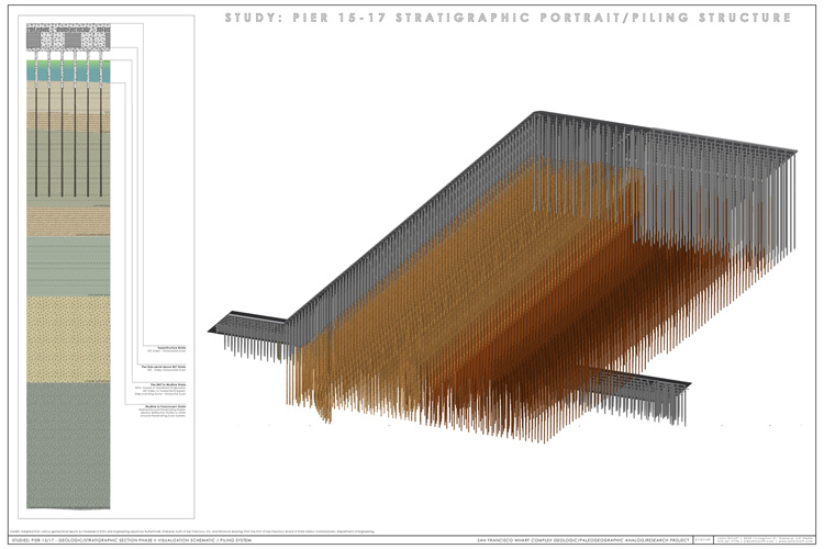
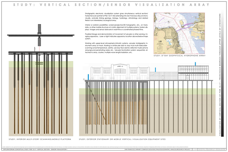
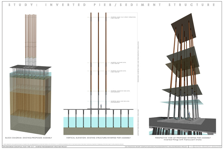
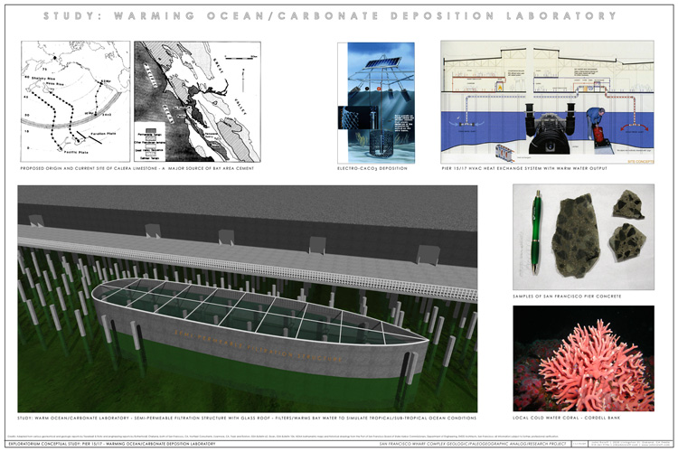
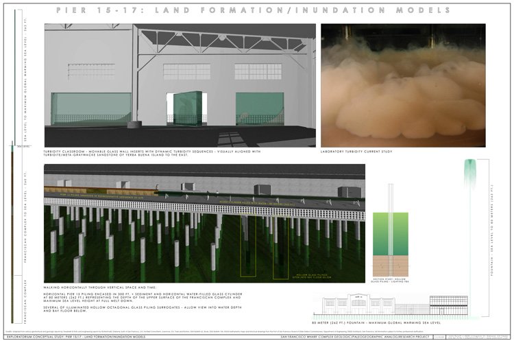
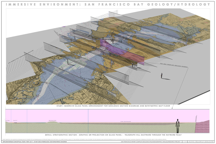
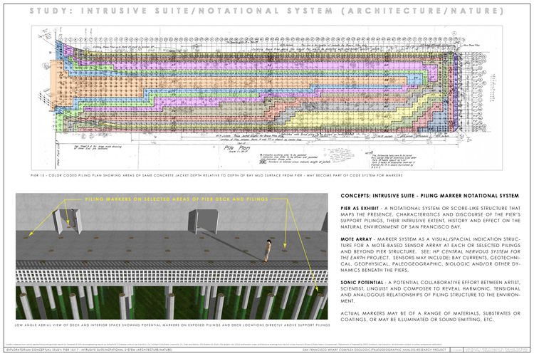
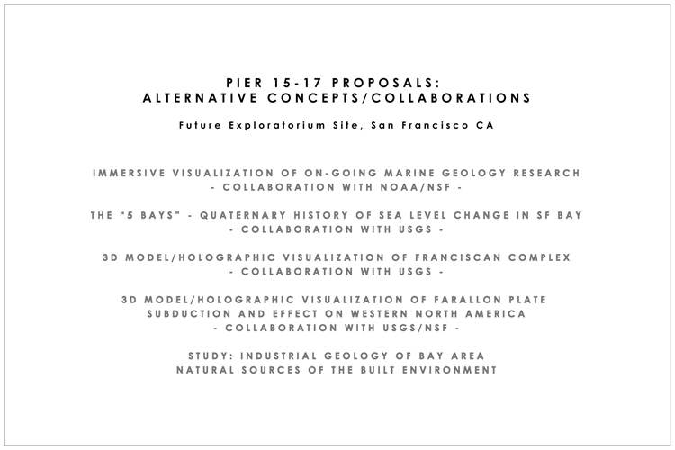
The diagrams shown represent a series of studies for potential projects or exhibits for the new Exploratorium site at piers 15/17, San Francisco, CA. They were developed through a several year-long research fellowship at the Exploratorium funded by the Bernard Osher Foundation and related grants. The initial earlies studies for pier-related projects came from a NSF grant for projects based at the piers of Fort Mason, San Francisco, CA, for which many concepts were formulated, many of these were synthesized in a meta-study titled: Selected Studies/Concepts: Pier I / Bay Sand Installation (Transport/Global Warming Analogs) // Tunnel (Metamorphism/Transport Analogs), 2008, this work is part of the Felsic/Mafic/Carbonate Facies series. All of these concepts are also related to the project, Yerba Buena Complex, 2008.
|
Adapted from various geotechical and geologic reports by Treadwell & Rollo and engineering reports by Rutherford& Chekene, both of San Francsco, CA, Norfleet Consultants, Livermore, CA, Trask and Rolston, GSA Bulletin 62, Sloan,
GSA Bulletin 104, NOAA bathymetric maps and historical drawings from the Port of San Francisco Board of State Harbor Commissioners, Department of Engineering, all information subject to further, professional verification.
Return to Research/Studies Menu